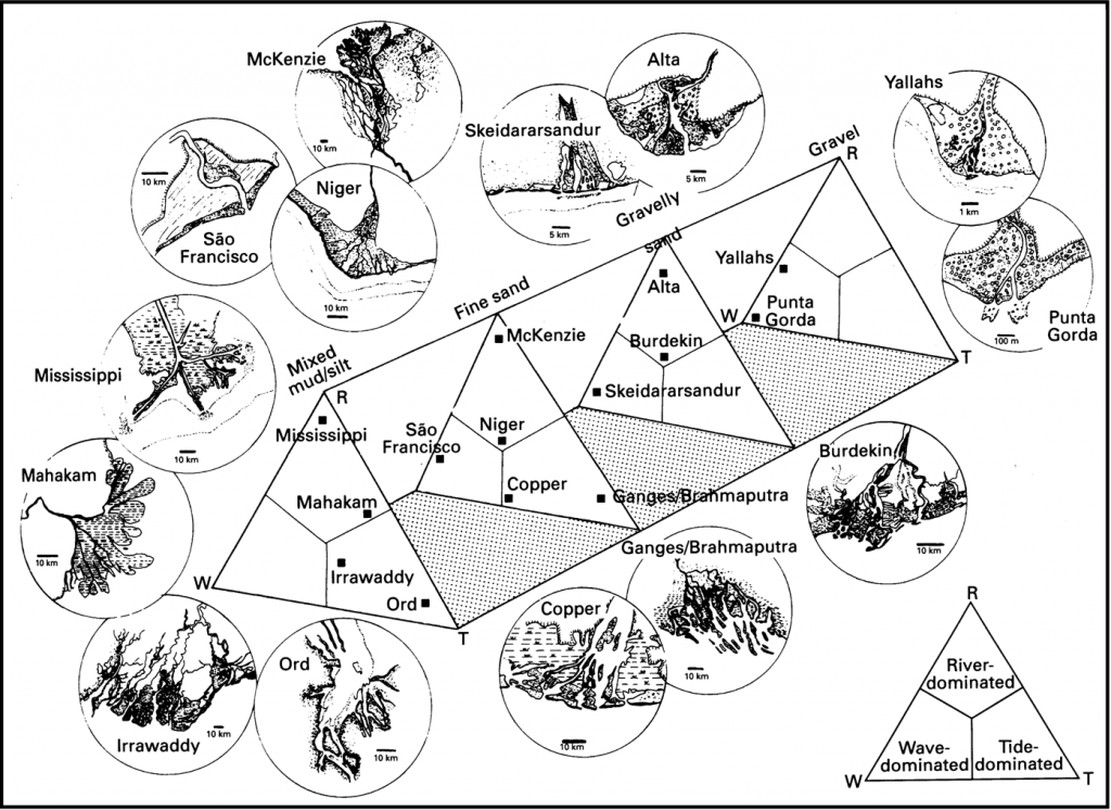
To understand a phenomena we need a mind model. If we are interested in deltas, this is a great mind model that you have probably already studied. It describes the range of possible deltas in terms of two main variables:
Grain Size: Is the delta gravelly, sandy, silty of muddy? That depends on the river supplying the sediment: Short steep rivers from small catchments are dominated by gravels; long slow, low energy rivers from big catchments are dominated by mud.
Processes: Has the delta formed on a coastline dominated by waves or by tides that could redistribute the sediments and change the geometry of the delta? If neither, the delta is said to be fluvially dominated (in which case sediment flux and volume are the main controls).
This is a great summary illustration from Orton and Reading (1993), but it is much more fun to look at the actual deltas in Google Earth. So I have found them all for you and you can see them on this map
ORTON, G.J. and READING, H.G. (1993), Variability of deltaic processes in terms of sediment supply, with particular emphasis on grain size. Sedimentology, 40: 475-512. doi:10.1111/j.1365-3091.1993.tb01347.x
No Comments Yet