
Skills, like bagpipe playing, need practice and management! We are in the process of building a simple skills portfolio management tool that will allow users to create their own “Job Descriptions” from the library of skills, then self-assess their competence using an industry-standard competence analysis framework. This tool will provide individuals with a means to manage […]
You are browsing archives for
Category: Applications
Articles which described the applications that are being developed for formative and summative training.
GeoScope
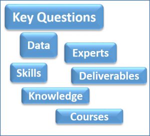
In any problem solving process, like the petroleum exploration industry, we are trying to find answers. But what are the questions? And who should we ask? And how will they address the problem? What skills do they have? What knowledge do those skills require? What should the outcome be? What kind of deliverables might we […]
GeoTree

One of the cornerstones of the interpretation process is the decision-making processes that we go through to draw our conclusions about any given geo-problem. Experts learn after years of experimentation and experience which questions to ask when, and where to find the answers. The aim of GeoTree is to try and capture these logical sequences of questions […]
GeoLink

This is an application that will capture the causal relationships between the the components of the natural geological systems that we study. For example, it is critical that we not only understand the components of a petroleum system (reservoir, source, seal and trap), but also their interdependence. In the example illustrated we are interested in determining the […]
GeoViewer

The GeoViewer App will provide a means to illustrate examples of geological interpretations that have been annotated by the interpreter. The geologists interpretation will be displayed in the interpretation window, together with hotspots highlighting the key features. In “Formative Mode”, clicking on hotspots will reveal explanations of the features tagged by the hotspots in the […]